West Rim Trail – Dead Horse Point State Park
Overview
Stand on the rim and watch the Colorado River sweep through deep sandstone canyons, cliffs glowing orange as the sun sets. The West Rim Trail is a Moab favorite for those who want nonstop views without the crowds of Arches. With easy access from the Visitor Center, family-friendly slickrock walking, and spurs to jaw-dropping overlooks like Big Horn, this hike is a perfect way to experience Dead Horse Point State Park.

Quick Trail Stats
Location: Dead Horse Point State Park, 45 minutes from Moab
Distance: 3.5 to 5.5 miles roundtrip
Time: 2–3 hours
Elevation Gain: Minimal (about 150 feet)
Difficulty: Easy to moderate (sun exposure, uneven slickrock)
Best For: Families, photographers, sunset seekers
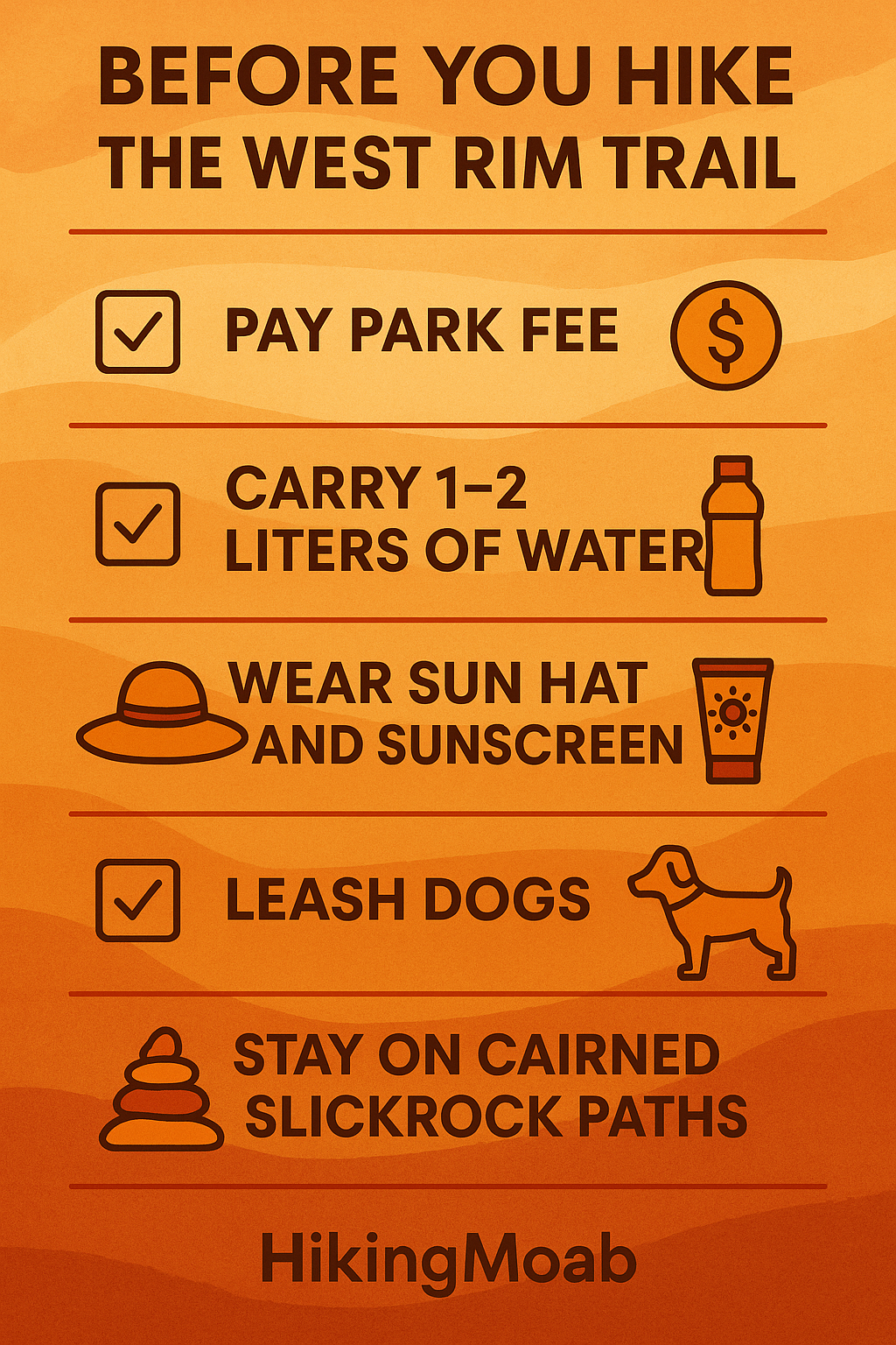
Dogs: Allowed on leash
Fee: Utah State Parks day-use fee required
Trailhead: Visitor Center parking lot
Quick Pick – Is This Trail Right for You?
✅ Best choice if you want: Big views in little time, sunset photos, a mellow family outing.
🚫 Skip if you want: A challenging workout, shade, or technical terrain.
🌟 Local Tip: Start an hour before sunset for glowing canyon walls and fewer crowds.
Getting There from Moab
Drive US 191 North from downtown Moab for 9 miles.
Turn left on UT 313 West, signed for Canyonlands and Dead Horse Point.
Continue 14 miles to the park entrance station and pay the fee.
Drive another 3 miles to the Visitor Center, where the trail begins.
The Visitor Center has water, restrooms, maps, and shaded picnic tables — a great place to stage your hike.
Trail Description
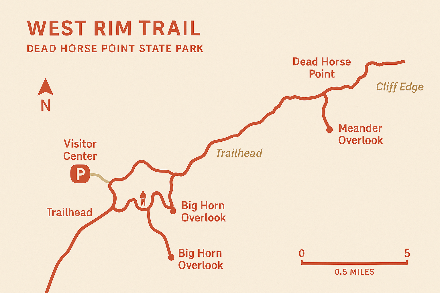
From the Visitor Center, follow cairns across slickrock and sandy patches. The trail hugs the rim with safe, wide benches offering views into Shafer Canyon and the Potash Road far below. Twisted junipers and desert wildflowers add bursts of color against the red rock.
About 1.5 miles in, a signed spur leads to Big Horn Overlook. You will notice a dramatic point that feels like the prow of a ship above the river. Many hikers turn around here for a classic 4–5 mile outing. For more solitude, continue farther along the rim to explore additional viewpoints and shifting angles on the river bends.
Expect sun exposure, uneven rock, and constant views. The trail is well marked, but always follow cairns and stay on slickrock where possible to protect the fragile desert soil.
Best Times to Hike
Fall & Spring: Ideal weather and colorful canyon light.
Winter: Quiet trails, crisp air, and long-range views (carry traction if icy).
Summer: Go at sunrise or sunset; bring extra water and sun protection.
Safety & Etiquette
Keep kids and pets close near cliffs.
Carry at least 1 liter of water per person (more in summer).
Wear sun protection and grippy footwear.
Stay on slickrock or marked trail to protect desert soils.
Pack out all trash — including dog waste.
What to Pack
Comfortable hiking shoes with good traction
1–2 liters of water per person
Sun hat, sunglasses, sunscreen
Snacks and camera
Light layers for changing weather
Headlamp if staying for sunset
Nearby Hikes
East Rim Trail – Shorter hike with La Sal Mountain views
Dead Horse Point Rim Loop Trail – Iconic viewpoint just steps from the parking lot
Colorado River Overlook Trail – Another easy option inside the park
FAQs
How long does the West Rim Trail take?
Plan on 2–3 hours for a roundtrip from the Visitor Center to Big Horn Overlook and back.
Is the trail kid-friendly?
Yes. The grade is gentle, but watch children closely near rim viewpoints.
Are dogs allowed?
Yes. Leashed dogs are welcome. Carry water for them and avoid hot rock surfaces.
Do I need a permit?
No hiking permit required, just the park day-use fee.
Which direction is best?
Start at the Visitor Center and hike clockwise toward Big Horn Overlook for the best flow.
Is the trail crowded?
Less crowded than Arches, especially in the morning or late afternoon.
What’s the best time for photos?
Sunset brings glowing cliffs and long canyon shadows. Morning is quieter and just as stunning.
Photography Tips
Golden hour glow: Capture warm light on the Wingate cliffs before sunset.
Foreground interest: Use junipers or cracked slickrock patterns to frame canyon shots.
Night skies: Dead Horse Point is an International Dark Sky Park — bring a tripod if staying late.
