BLM Land · No fee · UT-128 River Road
Fisher Towers
A 4.4-mile trail that threads the base of the strangest skyline near Moab — soaring red spires, fins and gargoyles, crowned by the Titan, the tallest freestanding rock tower in North America. No fee, dogs allowed, and light at the ends of the day that photographers plan whole trips around.
Distance and conditions verified July 2026
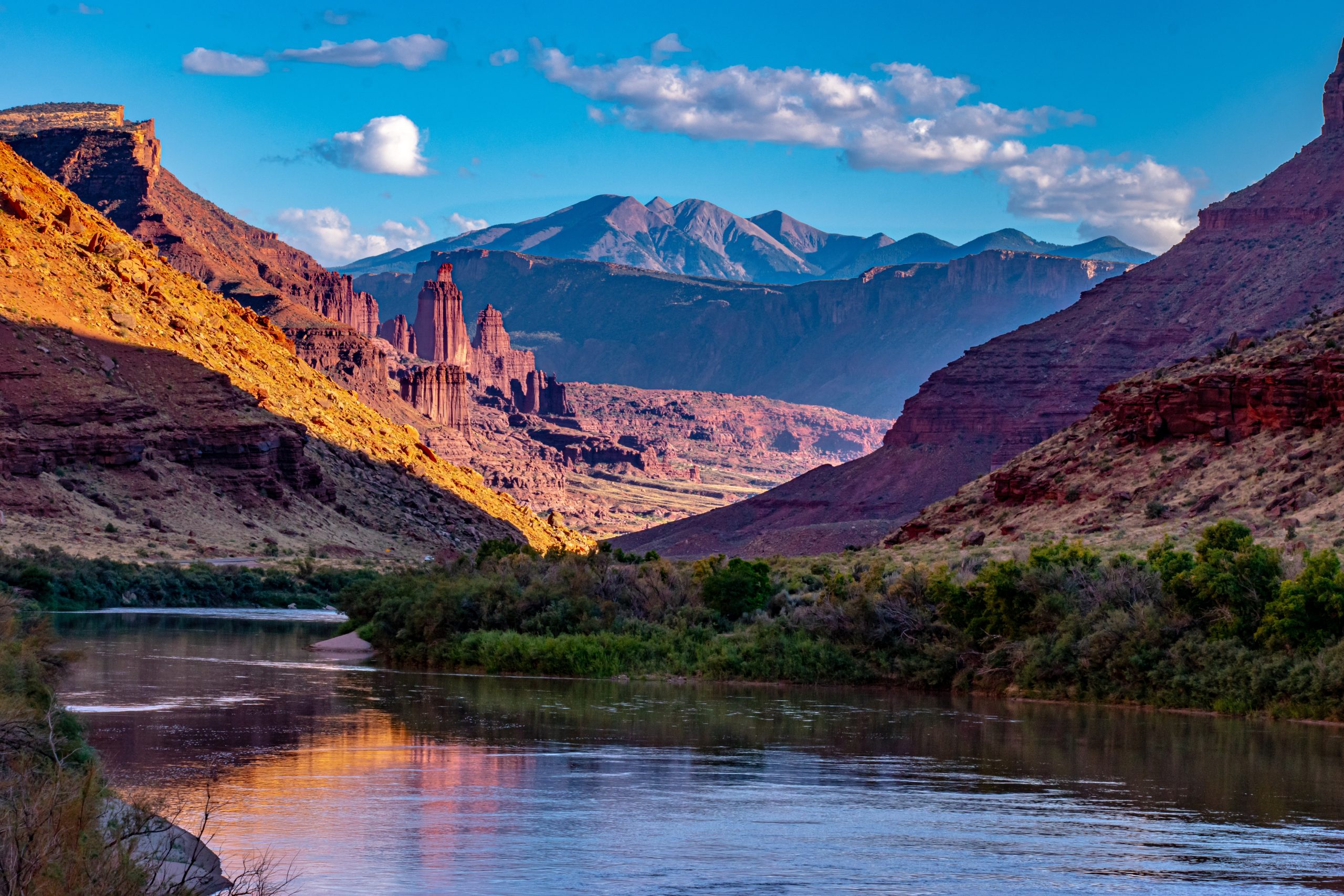
No fee, no reservation, dogs welcome. Fisher Towers is BLM land, so it skips the entrance fee and the no-dogs rule of the national parks. It is also one of Moab's great photography hikes — plan for the last two hours of daylight.
No shade anywhere on this trail. It faces open sky the entire way and the red rock radiates heat. In summer, hike it at sunrise or in the final hours before dark, never midday.
Why hike it
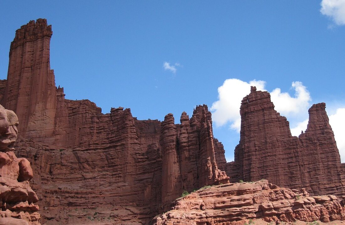
Fisher Towers is the most otherworldly hike near Moab, and the one that looks least like anywhere else on Earth. Instead of arches or canyons, you walk beneath a forest of dark red Cutler sandstone spires — capped with harder Moenkopi rock and draped in what geologists literally call mud curtains — rising as much as 900 feet straight out of the desert floor. Their names tell you the mood: the Titan, the Cobra, Ancient Art, Kingfisher, Cottontail.
The trail doesn't climb the towers. It threads between and beneath them, dipping into side canyons and traversing under vertical walls, so the skyline reorganises itself with every bend. It is also a working climbing mecca — you will likely see climbers high on Ancient Art's corkscrew summit or strung up the Titan, which adds a startling sense of scale when you spot a human speck on a wall you assumed was empty.
This is a photographer's hike above all. The towers face west and glow deepest red in the last hours of daylight, especially with snow on the La Sal Mountains behind them. If you care about the pictures, time your hike to finish at sunset — and bring a headlamp for the walk out.
Getting to the trailhead
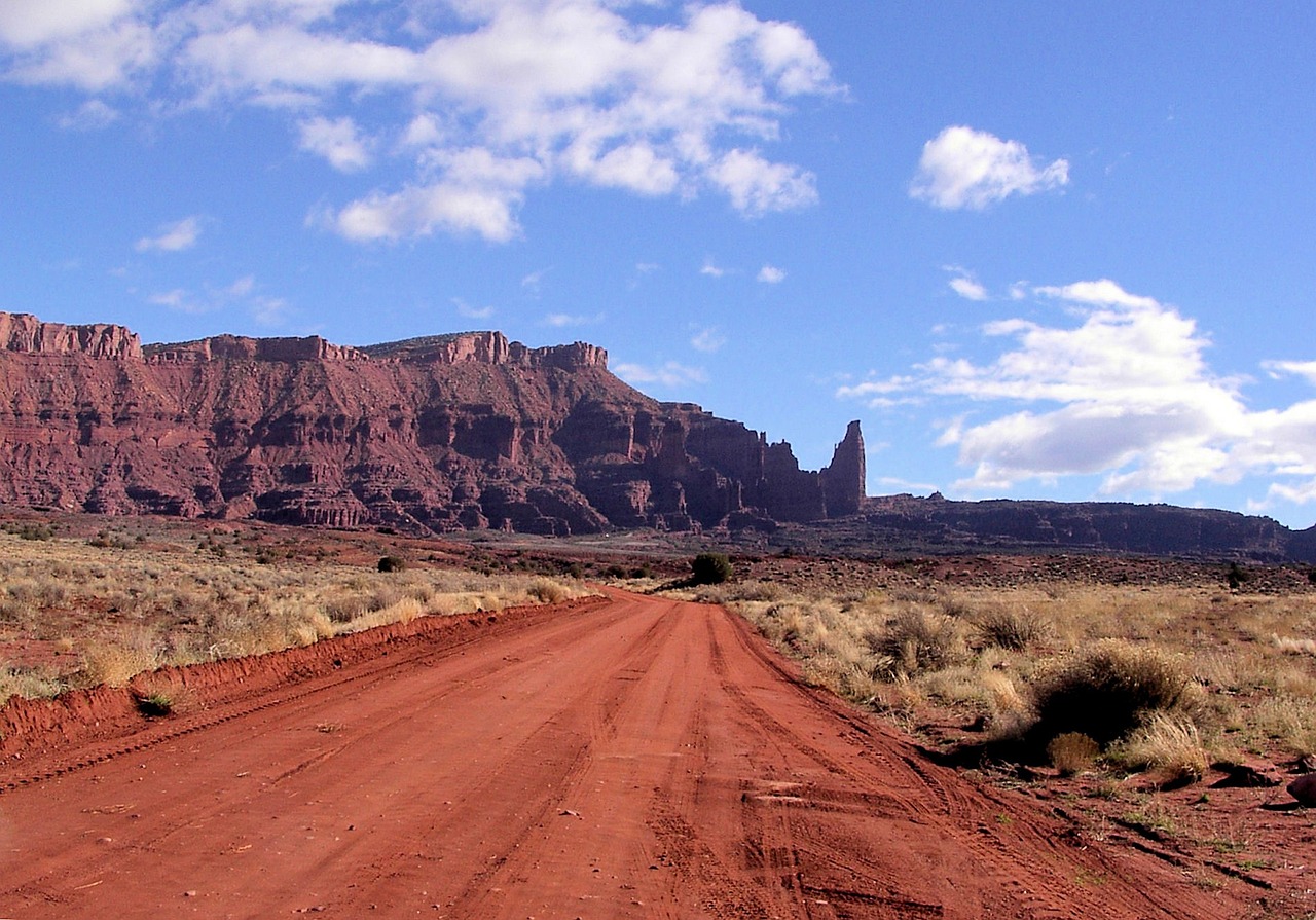
From Moab, head north on US-191 about 2 miles, then turn east onto UT-128 (the River Road) and follow the Colorado River for roughly 21 miles. Turn right at the signed Fisher Towers turnoff onto a gravel road and follow it about 2 miles to the trailhead and campground.
- Drive time: about 35 minutes from Moab, on one of the most scenic drives in the state
- Trailhead GPS: 38.7237, -109.3050
- Road: UT-128 is paved; the final 2 miles are graded gravel, fine for passenger cars when dry
- Facilities: pit toilet, trail register, picnic tables, and a small first-come BLM campground right at the trailhead. No water
- Parking: a modest lot that fills on spring and fall weekends and at sunset. Arrive with margin
The hike, step by step
0 – 0.3 mi
Down into the wash
From the trailhead the path descends a short slope, crosses slickrock, and drops into a canyon. You pass a junction with the Red Onion Loop early on — stay on the signed Fisher Towers trail. The towers rise ahead almost immediately.
~0.5 mi
Ancient Art
The trail rounds the west side of Ancient Art, the most-climbed formation here, with its unmistakable corkscrew summit. Look up — there is often someone on it. This is a common turnaround for a short out-and-back if you only want a taste.
~0.8 mi
The ladder
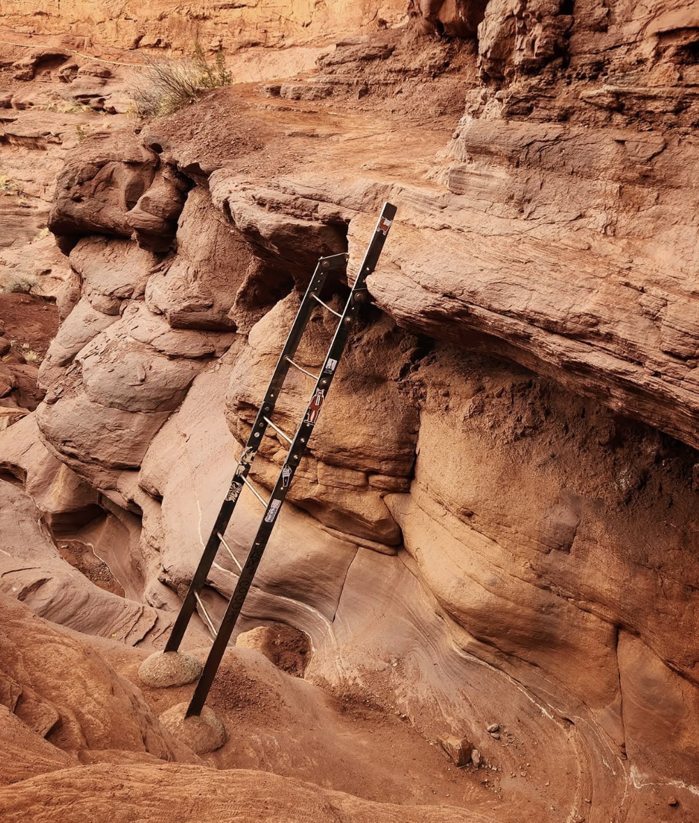
A short metal ladder drops you down a rock step, with a bolted handhold to grab. It looks sketchier than it is — it's secure enough that people descend it with a child carrier on. Take dogs down carefully. This is the one bit of the trail people remember.
0.8 – 2.2 mi
Beneath the towers
The heart of the hike. The trail undulates constantly in and out of side canyons beneath the Titan and Cottontail, the views reorganising at every turn. This up-and-down is why a 4-mile hike feels longer than 4 flat miles.
~2.2 mi
The end viewpoint
The trail climbs to a final ridge and opens up — the towers behind you, the Colorado River corridor and distant mesas ahead. The best view is looking back the way you came. Retrace your steps; the return light is often better than the way in.
Free printable field guide
Take this guide with you
Two pages built to print and fold. Trailhead GPS, the route with the ladder marked, the light timing, and the pack list — readable with no cell service, which is patchy out on UT-128.
- Trailhead GPS and the Red Onion junction to skip
- Where the ladder is and how to handle it with a dog
- Golden-hour timing for the towers
- Pack list and heat guidance for a shadeless trail
Safety
Fisher Towers is moderate and safe for most people, but the combination of no shade, no water, and a long exposed trail catches people out.
- Heat and sun. There is no shade anywhere and the red rock radiates it back. Carry more water than the distance suggests — at least 2 litres per person, more in summer — and hike the cool ends of the day.
- The ladder. Short and secure, but take it one person at a time and help children and dogs. It is the one spot where an awkward move has consequences.
- The undulation adds up. Constant up-and-down in and out of side canyons makes this more tiring than a flat 4 miles. Pace accordingly, especially in heat.
- Footing. The trail mixes packed dirt and slickrock, slick when dusty and treacherous when wet or icy. Follow the cairns; it is easy to wander off the line.
- Flash risk in the washes. The trail dips through drainages. Don't hike it during or after rain.
When to go
| Season | Conditions | Verdict |
|---|---|---|
| Mar – May | Prime. Mild temperatures and the towers at their most photogenic. Busiest at the trailhead. | Best |
| Jun – Aug | Shadeless and hot. Sunrise or the last hours before dark only. Midday is genuinely dangerous. | Ends of day only |
| Sep – Oct | Heat eases, low sun deepens the red, crowds thin. The photographer's season. | Best overall |
| Nov – Feb | Quiet and dramatic with snow on the La Sals behind the towers. Watch for ice on the ladder and slickrock. | Good, mind ice |
How it compares
| Trail | Distance | Fee | Dogs | The draw |
|---|---|---|---|---|
| Fisher Towers | 4.4 mi | None | Yes | Red spires, the Titan |
| Corona Arch | 3 mi | None | Yes | 140-ft arch, cables |
| Mary Jane Canyon | 7.8 mi | None | Yes | Water & narrows |
| Delicate Arch | 3.2 mi | Park fee | No | The iconic arch |
All three of the no-fee hikes above are on UT-128 or nearby BLM land — you can pair Fisher Towers with Mary Jane Canyon in a single day out on the River Road, one for its towers and one for its water. Neither charges a cent.
Common questions
How long is the Fisher Towers hike?
About 4.4 miles round trip to the main viewpoint, though sources range from 4 to 5.2 miles depending how far you go — the trail continues to a southern terminus and you can turn back at any point. Most people take 2.5 to 3.5 hours. Constant up-and-down makes it feel longer than the mileage.
Is it hard?
Moderate. Short but constantly undulating, with a brief ladder descent about a third of the way in. No sustained steep climbs, but the cumulative up-and-down and total lack of shade make it more demanding than 4 miles sounds.
Is there a fee?
No fee, no permit, no reservation — it's BLM land. Free parking, a pit toilet, and a small first-come campground at the trailhead.
Can I bring my dog?
Yes, on leash. Bring plenty of water — there's none on the trail and no shade. Help dogs down the short ladder; most owners lift smaller ones and coax larger ones.
What's the Titan?
The tallest freestanding sandstone tower in North America, about 900 feet from base to summit, and a serious world-class climbing objective. Hikers don't climb it, but the trail passes beneath it and it dominates the skyline.
When's the best light?
The last two hours before sunset, when the west-facing towers glow deep red — especially with snow on the La Sals behind them. Sunrise works too. Bring a headlamp if you stay for sunset.