Free Arches National Park Map + Hiking Guide
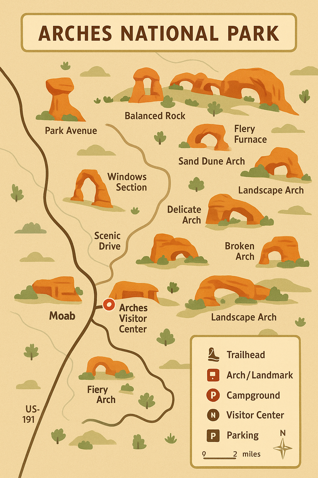
Exploring Arches is unforgettable — but it’s easy to get turned around without the right tools. That’s why we created this one-page map and hiking guide: clear, colorful, and designed by locals who know the trails. Inside, you’ll find a detailed illustrated map with every major trailhead, arch, campground, and viewpoint marked. The guide also includes quick facts, local tips, and a simple legend so you can navigate the park with confidence.
Here’s how to use it:
Download the PDF to your phone before you head into the park (cell service is limited).
Print a copy if you like to carry a paper map on the trail.
Use the legend to quickly find trailheads, restrooms, and points of interest.
Check the quick facts panel for essential tips like best seasons, must-see highlights, and water reminders.
Whether you’re hiking to Delicate Arch at sunrise or road-tripping through the Windows Section, this guide keeps the essentials in one place — so you can spend less time planning and more time exploring.
👉 Scroll down to grab your free download and start your adventure in Arches today.

Free Arches National Park Map + Hiking Guide
Planning your adventure in Arches? Don’t hit the trails without our beautifully designed one-page guide. This free download includes:
A detailed map of Arches National Park
Quick facts and must-see highlights
Trailheads, campgrounds, and viewpoints marked clearly
Insider tips from locals who hike Moab every day
Carry it on your phone or print it out — the perfect pocket companion for exploring Arches.
Quick Facts – Arches National Park
Location: 5 miles north of Moab, Utah
Size: 76,519 acres
Arches: Over 2,000 natural stone arches
Scenic Drive: 18 miles one-way
Must-See Highlights: Delicate Arch, Landscape Arch, Double Arch, Windows Section, Devils Garden
Campground: Devils Garden (reservations required)
Best Seasons: Spring & Fall
Tip: Carry at least 2 liters of water per person; limited shade
🥾 Trailhead
🏞 Arch / Landmark
⛺ Campground
🅿 Parking
👀 Viewpoint
🛑 Visitor Center
🚻 Restrooms
