The Harvest Scene Petroglyph Panel Guide
Introduction
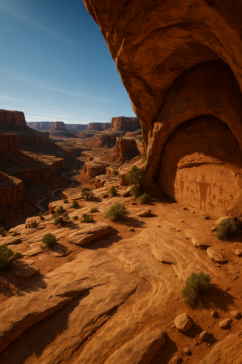
Deep in the Maze District of Canyonlands National Park lies one of the most intricate and culturally significant rock art panels in North America — The Harvest Scene Petroglyph Panel. Hidden in a remote alcove, this panel is a treasure from the ancient past, created by the Ancestral Puebloan (Anasazi) people more than a thousand years ago.
Unlike petroglyphs easily seen from a roadside pullout, the Harvest Scene is tucked away in one of the park’s most remote areas, accessible only via a long and challenging backcountry hike. Getting here requires preparation, skill, and respect for the cultural heritage of the site.
Discover More Canyonlands Rock Art
The Harvest Scene is just one of many incredible petroglyph sites in Canyonlands and the greater Moab area. Explore our guides to see where ancient artists left their mark across the desert.
See More Petroglyph Sites →
Plan Your Rock Art Road Trip →
History and Cultural Significance
The Harvest Scene is believed to date to the Late Basketmaker to Pueblo I period, roughly 900–1300 CE. These petroglyphs are carved into a sandstone wall using pecking and incising techniques.
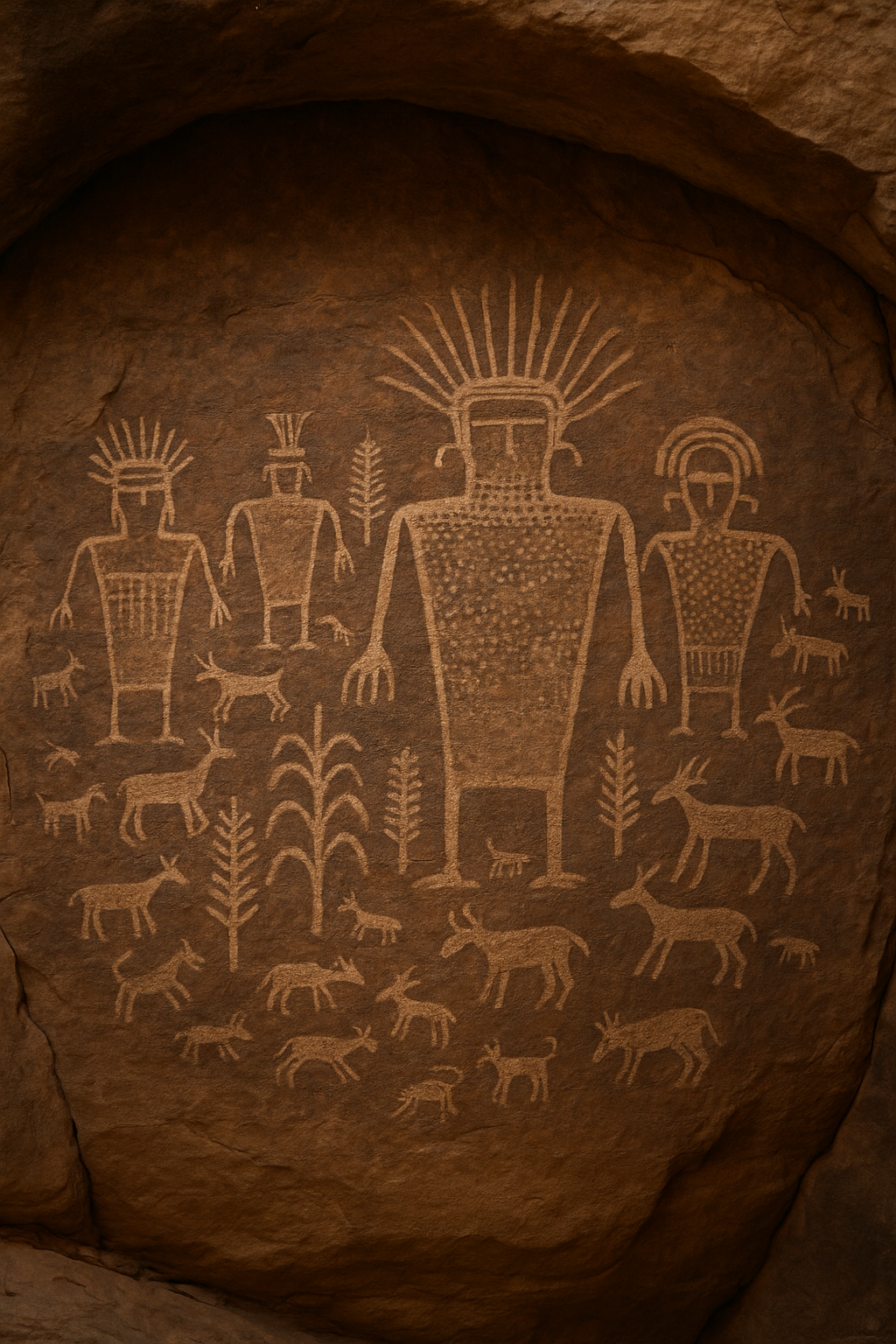
The panel features human figures wearing elaborate headdresses, possible depictions of agricultural tools, and designs that may represent plants, animals, or ceremonial regalia.
Many archaeologists believe the scene reflects a gathering or harvest ritual, perhaps tied to corn agriculture, which had become central to the culture of the Ancestral Puebloans.
Location and Access
District: Maze District – Canyonlands National Park
Nearest Towns: Hanksville or Green River, Utah
Access Roads: High-clearance 4WD required
Navigation: GPS, topo maps, and advanced route-finding skills
Permits: Required for overnight trips, strongly recommended for day hikes
Trail Overview
While multiple approaches exist, the most common route to the Harvest Scene starts from Maze Overlook.
Distance: 8–10 miles RT
Difficulty: Strenuous – scrambling, steep descents, route-finding
Elevation Change: 1,000–1,200 feet
Time: 8–10 hours round trip
Water: None available

Plan Your Maze District Adventure
The Maze is one of the most remote regions in the lower 48 — and that’s part of the magic. Our Maze District hiking and camping guides give you the details you need to travel safely and confidently.
Explore Maze District Hikes →
Overnight Permit Information →
Safety Tips
Travel in a group
Carry 1–2 gallons of water per person
Leave an itinerary with someone you trust
Expect slow travel — 1–2 mph average
Bring a satellite communicator
Photography Tips
Mid-morning or late afternoon for best alcove light
Use a tripod in low light
Zoom lenses capture detail without getting too close
Nearby Attractions in The Maze
Maze Overlook
Pictograph Fork panels
Chimney Rock
Ernie’s Country
Make It a Full Maze District Itinerary
Make It a Full Maze District Itinerary
You’ve already made the journey into one of the most remote places in the Southwest — why not see more? Use our itinerary suggestions to turn your Harvest Scene visit into a multi-day adventure.
Maze District Itinerary Ideas →
Top Canyonlands Backcountry Campsites →
Recommended Gear
High-clearance 4WD
Topo maps & GPS
Satellite communicator
Sun protection
First aid kit
Sturdy hiking boots
Lightweight layers
When to Visit
Spring/Fall: Ideal temps, stable weather
Summer: Extreme heat — start at sunrise
Winter: Short days, cold mornings
Protect and Explore
Every visitor plays a role in protecting Canyonlands’ cultural treasures. Learn how to visit rock art sites responsibly — and find more that are open to the public.
Responsible Rock Art Viewing Tips →
Find Guided Cultural Tours →
Getting There
Drive to Hans Flat Ranger Station (2–3 hours from Hanksville or Green River).
Continue via 4WD road to Maze Overlook (~3 hours).
Descend into the Maze via steep slickrock gullies.
Navigate across benches and through canyons to reach the alcove.
What You Will See
The Harvest Scene features:
Human figures with elaborate headdresses
Possible depictions of corn plants
Animal images — likely deer or bighorn sheep
Geometric shapes and patterns
Preservation and Ethics
Never touch the panel — skin oils damage the patina.
Do not chalk, trace, or apply anything to the rock.
Photograph without flash.
Stay on durable surfaces and avoid cryptobiotic soil.
Get Your Free Canyonlands Hiking Map
Download our printable Canyonlands hiking map with marked petroglyph locations, popular backcountry routes, and campsite zones. Perfect for planning and for offline navigation in the field.
Download Map Pack →
See All Canyonlands Hiking Guides →