Hike the Long Bow Arch Trail
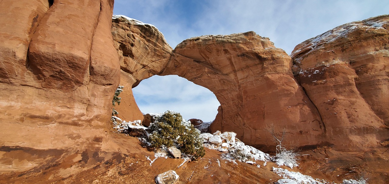
The crunch of desert sand under your boots. The shimmer of ancient petroglyphs glowing in the morning sun. A scramble up slickrock that suddenly opens into a wide amphitheater of red stone, crowned by a graceful arch high above.
That’s the reward of the Long Bow Arch Trail—a short but adventurous hike tucked away off Potash Road. Overshadowed by nearby Corona Arch, this trail is often overlooked, which means you’ll likely have the desert to yourself. For hikers who want Moab’s beauty with a dash of solitude, Long Bow Arch is the perfect find.

Quick Facts
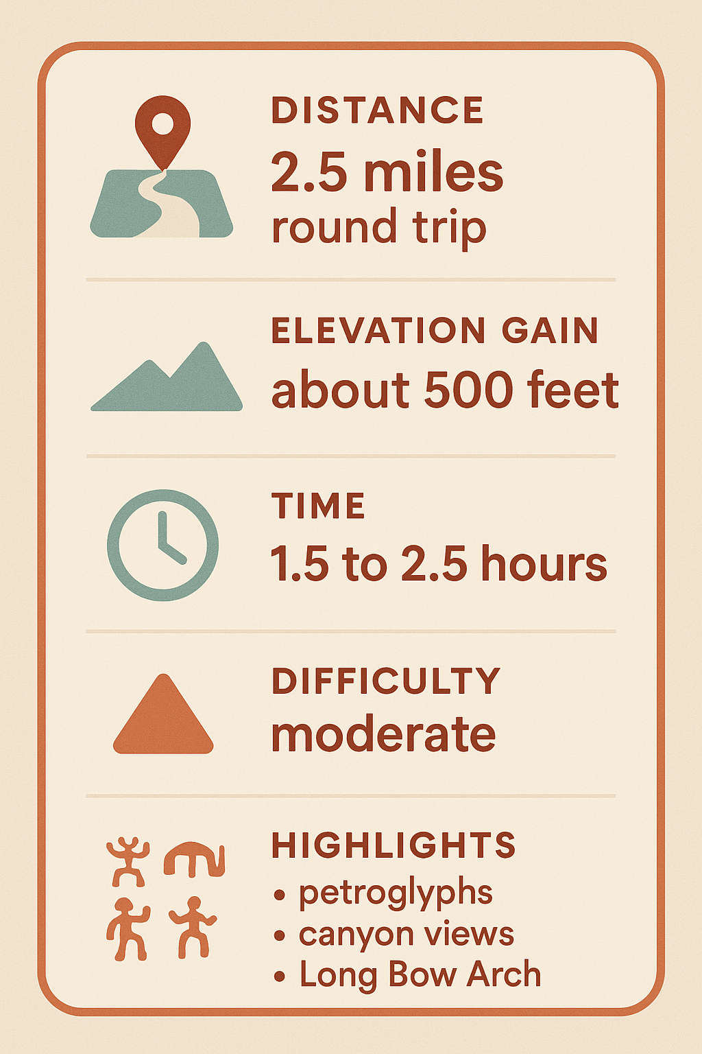
| Location | Potash Road (UT-279), 10 miles from downtown Moab |
| Distance | 2.5 miles round trip |
| Elevation Gain | ~500 feet |
| Difficulty | Moderate (slickrock scramble + handrail section) |
| Time Required | 1.5–2.5 hours |
| Best Seasons | Spring & Fall (avoid midday summer heat) |
| Highlights | Long Bow Arch, petroglyph panels, slickrock views, solitude |
What Makes the Long Bow Arch Trail Worth Exploring?
Moab is full of show-stopping arches, but Long Bow Arch feels like a secret. The hike offers:
Scenery without the crowds – You’ll often have the trail nearly to yourself.
Petroglyphs along the way – Rock art panels carved by ancient peoples.
A fun sense of adventure – Slickrock scrambles and a short handrail section.
The payoff: Long Bow Arch – A graceful span of sandstone tucked into a quiet amphitheater.
This trail is a great option if you want something short, scenic, and off the beaten path.
Getting to the Trailhead
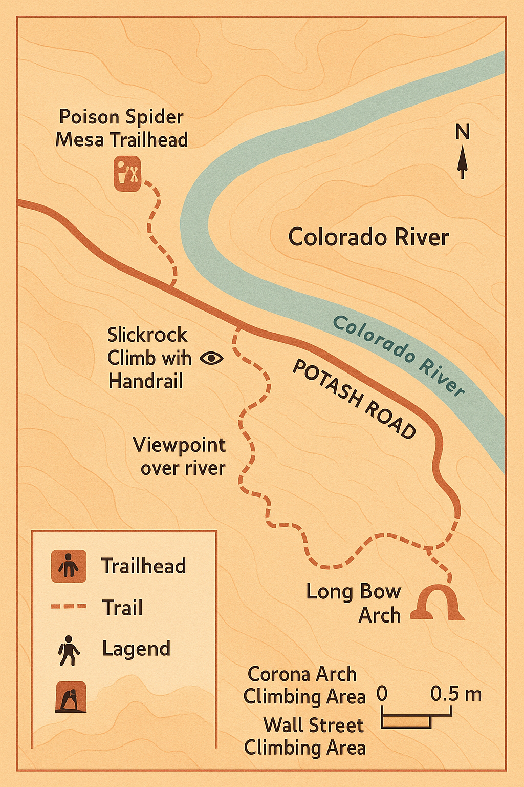
The Long Bow Arch Trail begins at the Poison Spider Mesa trailhead on Potash Road.
Directions from Moab:
Drive north on US-191 for about 5 miles.
Turn left onto Potash Road (UT-279).
Follow Potash Road along the Colorado River for 6 miles.
The Poison Spider Mesa parking area will be on your left, well-marked.
- Parking is free, but the lot is shared with off-road users. Arrive early on weekends for best availability.
- Pro Tip: On the drive, keep your eyes peeled—Potash Road is lined with petroglyph panels and rock climbers scaling the cliffs at Wall Street.
Trail Description: Step-by-Step
The hike is about 1.25 miles each way. Here’s how it unfolds:
0.0 miles – Trailhead & Petroglyphs
Cross the road from the Poison Spider parking lot. Within minutes, you’ll spot petroglyphs etched into the sandstone walls. Pause to take them in—these stories have been preserved for centuries.0.4 miles – Slickrock Climb
The trail leaves the wash and ascends slickrock. Look for painted dinosaur track symbols to guide you. A short section features a metal handrail for support—take it slow if heights make you uneasy.1.0 miles – Canyon Views
As you climb, the landscape opens up. Look back for sweeping views of the Colorado River winding through red rock cliffs.1.25 miles – Arrival at Long Bow Arch
The arch comes into view, spanning gracefully above the sandstone amphitheater. It’s a perfect place for photos, snacks, and quiet reflection before heading back the way you came.
Safety Callout: Desert Essentials
⚠️ Stay Safe on the Long Bow Arch Trail
Carry at least 2 liters of water per person.
Wear sturdy hiking shoes—slickrock can be slippery with sand.
Protect yourself from the sun (hat, sunscreen, sunglasses).
Avoid midday summer hikes; start early or go late.
Watch kids closely at the slickrock and handrail section.

Best Time to Visit
Spring (Mar–May): Pleasant temps, desert flowers, perfect conditions.
Fall (Sep–Oct): Crisp air, golden light, fewer crowds.
Winter: Quiet trail, but be prepared for icy slickrock.
Summer: Extremely hot—only hike early morning or evening.
What to Bring
Water (2+ liters per person)
Snacks for the trail
Sturdy shoes with grip
Sun hat and sunscreen
Trekking poles (optional for slickrock)
Camera or phone for petroglyphs and arch views
FAQs Long Bow Arch Trail
How long does it take to hike Long Bow Arch?
Most hikers complete it in 1.5–2.5 hours.
Do I need a permit?
No permits are required.
Can I bring my dog?
Yes, dogs are allowed on-leash. Be cautious in hot weather—slickrock burns paws.
Is this trail family-friendly?
Yes, though young kids may need help on the slickrock and handrail sections.
Is the trail in Arches National Park?
No. It’s on BLM land off Potash Road, no fee required.
Next Adventures After Long Bow Arch
Hike Corona Arch for an even bigger sandstone span.
Try Hunter Canyon Rim Trail for lush desert scenery.
Book a guided canyoneering tour in Moab to experience rappelling and slot canyons.
Drive Potash Road to Jug Handle Arch and other hidden gems.

