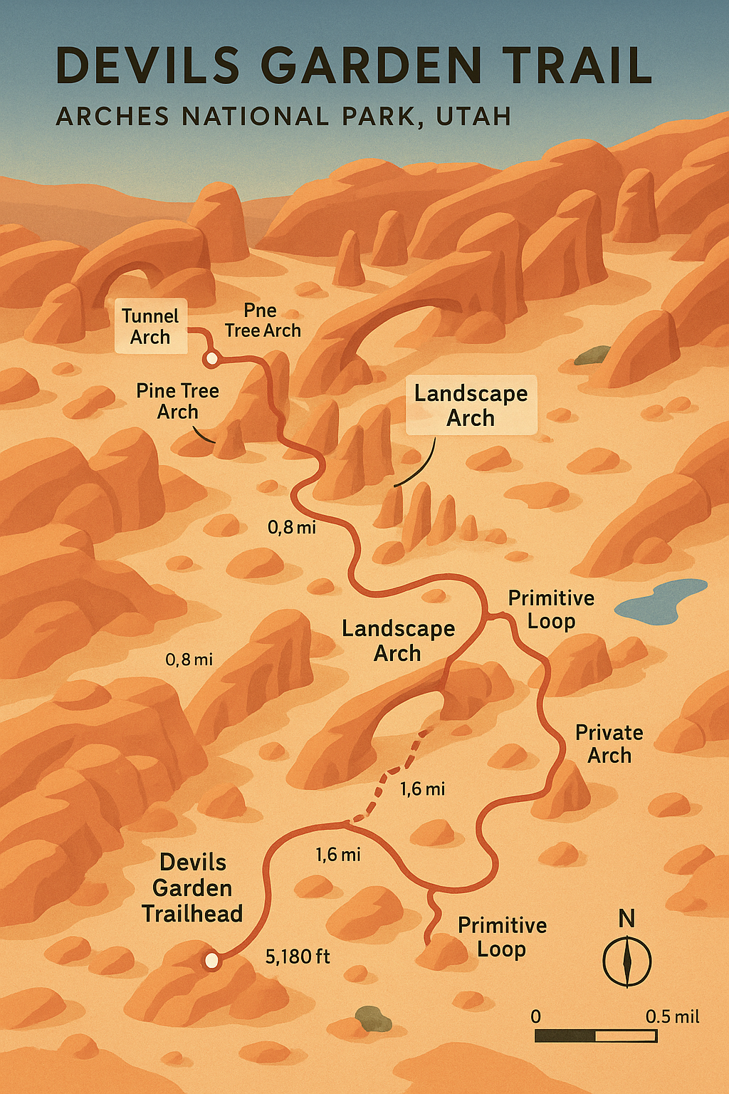
Devils Garden Hiking Trail Arches National Park
Overview
The Devils Garden Trail is the crown jewel of hiking in Arches National Park. Known for its collection of natural arches, fins, and spires, this trail offers a journey deep into the heart of the park’s most dramatic landscapes. With up to seven distinct arches to visit, including the famous Landscape Arch, hikers can customize their route from an easy stroll to a full-day adventure. Whether you are here for photography, geology, or the thrill of exploring winding sandstone corridors, Devils Garden delivers an unforgettable Moab hiking experience.
Quick Facts
Trailhead Location: Devils Garden Trailhead, Arches National Park
Trail Type: Out-and-back with optional loop sections
Distance: 1.9 miles (to Landscape Arch) up to 7.9 miles (full primitive loop)
Difficulty: Easy to strenuous depending on distance chosen
Elevation Gain: 1,000 feet on the full route
Best Seasons: Spring and fall for cooler temperatures and stable weather
Permits: No permit required for day hiking, but timed entry reservation required for park access during peak season
Facilities: Restrooms, picnic tables, and drinking water at the trailhead
Getting to the Trailhead
From Moab, drive north on US-191 for approximately 5 miles to the Arches National Park entrance. Continue along the main park road for 18 miles, passing viewpoints and trailheads until you reach the very end of the road. The Devils Garden parking lot is large but fills quickly, especially in spring and fall. Arrive before 8:00 a.m. for the best chance at parking.
Trail Description
Section 1: Devils Garden to Landscape Arch
The first 0.9 miles of trail are well maintained and relatively flat, making it accessible for most hikers. You will pass Tunnel Arch and Pine Tree Arch on short spur trails to your right — both worth the quick detour. The main path continues to the stunning Landscape Arch, one of the longest natural stone spans in the world at 306 feet. This section is the most popular and suitable for families.
Section 2: Landscape Arch to Double O Arch
Beyond Landscape Arch, the trail becomes more rugged. You will scramble over narrow sandstone fins with exposure on both sides, which may be intimidating for some hikers. Along the way, you can visit Partition Arch and Navajo Arch via short spurs. The main route leads to Double O Arch, a striking formation with two stacked arches that offers a fantastic lunch spot.
Section 3: Primitive Loop
For experienced hikers looking for solitude, the Primitive Loop is the most adventurous option. This 2.1-mile extension beyond Double O Arch involves route-finding, uneven surfaces, and a few mild scrambles. You will encounter Private Arch and pass through remote fins before reconnecting with the main trail.
Safety and Preparation
Footwear: Sturdy hiking shoes with good grip are essential due to slickrock and uneven surfaces.
Water: Carry at least 2–3 liters per person, more in summer.
Sun Protection: Minimal shade; bring a wide-brimmed hat, sunglasses, and sunscreen.
Weather Awareness: Avoid hiking in storms; sandstone becomes slippery and lightning risk is real.
Primitive Loop Note: Not recommended during rain or snow due to hazardous conditions.
Photography Tips
Best Light: Morning light illuminates Landscape Arch beautifully; afternoon light casts dramatic shadows on Double O Arch.
Wildflowers: Spring blooms add pops of color to the desert landscape.
Night Photography: The Devils Garden area is ideal for stargazing and Milky Way photography, with minimal light pollution.
Nearby Attractions
Skyline Arch: Just south of the trailhead, visible from the road or a short hike.
Sand Dune Arch: A fun, sandy detour perfect for kids.
Fiery Furnace Viewpoint: Offers sweeping views of another maze-like section of the park.
Suggested Itineraries
Short Hike: Devils Garden to Landscape Arch and back (1.9 miles round trip)
Half-Day Adventure: Landscape Arch to Double O Arch and back (4.2 miles round trip)
Full-Day Exploration: Full Devils Garden Primitive Loop with all spur trails (7.9 miles)
